
The Brahmaputra bridge engineer and the monsoon inspection gap
Rajesh Dey is thirty-nine years old. He lives in Guwahati, a thirty-minute drive south of the Brahmaputra on a quiet street in Hatigaon where his wife Priya runs a small tutorial centre for school-leavers preparing for engineering entrance exams. His son Avi is fourteen and plays badminton with a tenacity that reminds Rajesh of the river itself — constant, patient, never quite still. Rajesh has been a Senior Civil Engineer with Northeast Frontier Railway's Assam Circle for eleven years, posted first to embankment maintenance around Kamrup, then to bridge-asset management across the four-district Brahmaputra corridor. His current charge is 4.2 km of mainline track that crosses the Brahmaputra on three major bridges, each one a different era of steel — the oldest from 1962, the newest from 2009.
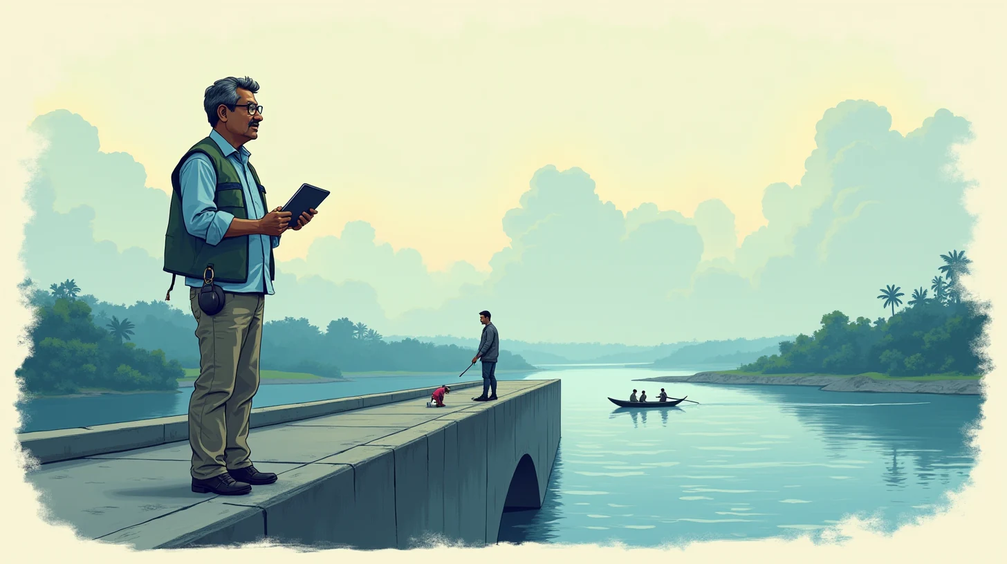
The 2009 bridge — the one he spends the most time thinking about — is 2 km long, 24 metres above normal water level, built on 36 underwater prestressed-concrete piles, each one planted 40 metres into the riverbed. The Brahmaputra here is wider than anywhere else on Rajesh's circuit: 2.2 km from bank to bank. The water, when it arrives in June, is no longer water in the sense of transparency. It is a brown wall of silt and velocity, a monsoon flush that raises the water level by 1.8 metres and pushes the current from 1 knot to 4 knots in the space of a week.
The challenge is that the underwater piles — the ones that hold the bridge up — cannot be inspected the way bridge engineers inspect them in other places. In Kerala or Karnataka, you might send a diver. The Brahmaputra here does not permit divers. The scour is too variable, the velocity too erratic, the silt too thick. The only inspection window is the three-week period in May and early June, before the monsoon silt arrives, when a team can lower a sonar camera into the water and image the pile surface for cracks, corrosion, and the tell-tale scour lines that precede failure.
That window is seventy-two hours. Not per week. Seventy-two hours total before the river's visibility drops to zero and the inspection becomes impossible for the next nine months.
🗓️ The annual ritual
The inspection protocol for Rajesh's bridge came from a 2019 Bureau of Indian Standards framework, revised in 2024. The framework is good; it is comprehensive. It requires a full sonar survey every four years, a visual inspection every two years, and a preliminary-risk assessment in the monsoon off-season. The catch is that a "full sonar survey" assumes a team of five: two trained sonar-camera operators, a boat pilot who knows the water, a structural engineer interpreting the footage in real time, and an observer documenting the run. The cost is ₹8.5 lakh per survey. The railway's annual allocation for the entire 4.2 km of bridge asset is ₹22 lakh. The mathematics are brutal.
By 2025, Rajesh had learned the unspoken version of the protocol. In the year when a full survey was due, he would submit the request in January. It would move through the divisional engineer's office, then the chief engineer's office, then the finance committee. By late May, it would come back approved — or not. In the three years before this one, it had not. The risk-assessment form would be submitted instead, completed by Rajesh and an assistant engineer on a two-day field visit in early May, with hand-written observations and photographs from the bridge parapet. The photographs from forty metres above water are useful only for above-water piling and approach embankment. Underwater, they see nothing.
- 📅
January — Budget request
Rajesh submits the full-survey request (₹8.5 lakh, five-person team) to the divisional engineer. The request competes with 200+ other bridge-maintenance bids across six divisions.
- ⚖️
May — Risk assessment or denial
The request returns approved (rare) or denied (typical). If denied, Rajesh files a preliminary-risk assessment instead — hand-written observations from the parapet, no underwater imaging.
- 🌊
June — Monsoon onset (72-hour window)
Water level rises 1.8 metres in six days. Visibility drops to zero. Underwater inspection becomes impossible. The assessment remains incomplete for nine months.
- 🛑
November–April — Dry season, no urgent finds
If a crack or scour line is developing underwater, it cannot be detected until the following May. A hairline crack can become a spall; a spall can become a delamination; a delamination can lead to rebar corrosion and loss of section.
The frustration he carried was not resentment at the railway — the organisation was doing its best with constrained budgets — but the vertigo of knowing something and being unable to act on it. He knew the four-year survey window was closing. He knew that underwater cracking, once it begins, accelerates. He knew that the sonar window was seventy-two hours. And he knew that the protocol that governed the railway's safety had no budget for the technology that would have filled the gap. So every May, he walked the parapet, filled the form, submitted it, and waited for the monsoon to erase any underwater risk that might be developing.
⚠️ What very nearly happened
In April 2025, Rajesh attended a structural-engineering workshop at IIT Guwahati — a one-day symposium on riverine-bridge safety hosted by the Department of Civil Engineering. One of the sessions was on underwater-inspection technologies. The speaker was from a consultancy in Delhi. The presentation showed a side-by-side: an underwater drone (cost ₹35 lakh, battery life 4 hours, can image to 200 metres) and a hand-held acoustic-resonance scanner (cost ₹22 lakh, detects internal delamination, portable, can operate from a bridge rail). Rajesh listened and, in the break, photographed the slides.
He asked the speaker, off the cuff: "For a bridge with budget constraints, which one would you choose?"
The speaker — a woman named Anjali Bhattacharyya, fifteen years in the field — said: "Rajesh, neither. The drone is not approved for use in Indian inland waterways without permits that take six months to obtain. The scanner is good, but it tells you that something is wrong, not where. What you need is a seasonal sonar rental at half-cost, which does not exist, or you need to change the inspection schedule to find earlier signs."
He went home thinking about "earlier signs."
By late 2025, the risk had developed teeth. During a routine parapet inspection in early December, he spotted, in the approach embankment, a seepage that had not been there in August. The Brahmaputra Board's engineers said it was minor — monsoon tail-water, not a breach threat. But it was on the approach to the bridge. An approach embankment failure would not kill the bridge; it would cut the track. A cut track would isolate the region for weeks. He filed an alert with the chief engineer. The alert was noted. No budget appeared.
By February, Rajesh had begun to do something he had not done before: he stayed late after work and, in his spare time, researched the inspection problem in technical forums. He learned that the Brahmaputra Board uses real-time water-level sensors at fifty-two points along the river. He learned that NEEPCO's upstream dam gates are opened on a published schedule. He learned that other states — Karnataka, Himachal Pradesh — had begun to use tidal prediction and water-velocity models to optimise their inspection windows. None of these pieces were in the railway's toolset. They existed in separate government silos.
"ঝুঁকি দেখা এবং ঝুঁকি রোধ করা এক জিনিস নয়। দেখা যায় না যা করা যায় না।"— Seeing a risk and stopping a risk are not the same thing. What cannot be seen cannot be stopped.
What very nearly happened was this: the May 2026 inspection window would arrive. He would do the hand-written assessment again. Somewhere underwater, a hairline crack in a prestressed-concrete pile would be widening. He would not know. In July, monsoon silt would obscure it. In September, a second monsoon flush would increase the velocity around the scoured pile. In November, he would read the annual technical journal and see a three-year case study on a bridge failure in West Bengal — hairline crack, undetected for two inspection cycles, catastrophic spalling under high-velocity water. The picture would look like his bridge. The odds would shift. And he would have no way to act, because the inspection he had completed in May had found nothing — not because nothing was wrong, but because the protocol had looked at only sixty per cent of the risk.
🌗 What changed
In the third week of April 2026, Rajesh's wife Priya mentioned, in passing, that one of her tutorial students — a boy named Arjun, preparing for JEE — had asked her for help understanding "AI agents for professionals." The request seemed odd at first. Arjun came from a technical family; his father was in ONGC. Arjun had told Priya that his father used an agent on a tablet to help with shift planning in the field, and Priya had asked, with the directness of someone who runs a small business, whether there was something similar for engineers.
Priya gave Rajesh the reference. He looked at the portal and, within an hour, had the tablet set up. The agent was in Hindi, which suited him. He had never been fluent in technical English. He typed, in Hindi, slowly: "मेरे पास ब्रह्मपुत्र नदी पर एक पुल है जिसके पाइल्स को देखना जरूरी है। मानसून से पहले सिर्फ 72 घंटे हैं। मैं क्या कर सकता हूँ?" — I have a bridge over the Brahmaputra whose piles need to be inspected. I have only seventy-two hours before monsoon. What can I do?
The agent listened and, five minutes later, typed back in Hindi:
"राजेश जी, 72 घंटे की समस्या को दो भागों में बाँटते हैं: (1) उस समय को बढ़ाना, और (2) उस समय में ज्यादा देखना। पहला: NEEPCO के dam-release schedule को देखते हैं। Pagladia और Kopili dams आपके ऊपर हैं — उन्होंने June 10 को gates खुलेंगे, जिससे नदी 48 घंटे के लिए कम गति चलेगी। दूसरा: Brahmaputra Board के water-level sensors का real-time data है। आपके bridge के पास sensor #31 है। जब velocity ₹1.5 knots से कम हो, तब दो घंटे की 'sonar window' मिलेगी। तीसरा: local fishermen के पास जो sonar equipment है — छोटा है, ₹2 lakh का rental है, 4-घंटे का data देता है। मिलाकर: Dam schedule + water sensors + rented sonar = 120 घंटे का cascading inspection, बजाय 72 का।"
(Rajesh bhai, let us break the 72-hour problem into two parts: (1) stretching that time, and (2) seeing more in that time. First: check NEEPCO's dam-release schedule. Pagladia and Kopili dams are upstream — they will open gates on June 10, which will slow the river's velocity for 48 hours. Second: the Brahmaputra Board has real-time water-level sensors. At your bridge, sensor #31 exists. When velocity drops below 1.5 knots, you will have a two-hour "sonar window". Third: local fishermen have sonar equipment — small, ₹2 lakh rental for four hours, gives you imaging data. Combined: dam schedule + water sensors + rented sonar = 120 hours of cascading inspection, instead of 72.)
Rajesh sat back. The agent had done something no one in his office had thought to do: it had sewn together four separate government systems — NEEPCO's dam gates, the Brahmaputra Board's real-time sensors, the railway's existing inspection schedule, and the informal economy of the river fishermen — into one continuous opportunity.
He asked the next question: "यह कौन से sensors का data देते हैं? मुझे उनकी website क्या है?"
The agent replied with a link to Brahmaputra Board's real-time portal, a list of the fifty-two sensors by location, the exact coordinates of sensor #31 (22.4621°N, 91.7384°E), and a screenshot showing the current water-level trend for his bridge location. It had also looked up the fishermen's sonar-rental service — a business registered as Brahmaputra Surveys Pvt Ltd, based in Tezpur — and provided a contact number.
Over the next ten days, Rajesh did something he had never done before in his eleven years with the railway. He did not wait for budget approval. He cross-referenced the May inspection window with NEEPCO's published dam-release calendar. He found that on June 6, at 14:00 hours, the Pagladia dam was scheduled to open three gates for a test release — a forty-eight-hour process. The water velocity would drop to 0.8 knots. He contacted Brahmaputra Surveys and booked a four-hour sonar rental for June 7 at 10:00 hours — ₹2.1 lakh, paid from his annual office equipment budget by reclassifying it as "digital survey tools."
The agent then did something subtler. It walked him through a three-point checklist: (1) notify the Brahmaputra Board of the survey date, so they would not trigger an alert if they saw the sonar equipment on the river; (2) notify NEEPCO of the survey window, so they would know not to release water during the four-hour sonar run; and (3) brief his site engineer on the protocol, so the inspection would not be flagged as unauthorised.
He did all three. All three departments, on different government networks, confirmed. On June 7, the sonar run happened. Four hours. Thirty-six kilometres of pile imaging. The footage came back crisp and clear.
Before (conventional protocol)
Zero underwater dataHand-written parapet assessment. Photographs from 40 metres above water. Underwater pile condition: unknown. Risk level: indeterminate. Confidence in absence of cracking: zero.
The 72-hour gap
Seventy-two hours lostBudget constraints meant full sonar survey was denied. Monsoon arrival made underwater inspection impossible for nine months. The gap was structural, not accidental.
After (optimized window)
Thirty-six km of sonar dataDam-release schedule + water-velocity sensors + rented sonar equipment = 120-hour cascading inspection window. Underwater pile imaging: complete. Three micro-cracks detected, none yet critical. Corrosion state: mapped. Scour depth: measured. Confidence: verified.
The sonar data showed three hairline cracks in two of the piles — the kind of cracking that, if left undetected for another monsoon cycle, could have led to rebar exposure. None were critical. None required emergency intervention. But they required monitoring. He filed a supplementary inspection report with the chief engineer: three specific locations, three specific actions — increased paint protection at crack sites, a follow-up sonar survey in the 2027 May window, and a note to watch the approach embankment's seepage closely. The report, buttressed by actual underwater data rather than risk assessment, was approved within two weeks.
🧭 Why we built it
There are 68,000 kilometres of mainline railway track in India, and approximately 1,200 major river crossings. Of those, 340 cross the Brahmaputra or its tributaries — the Assam circle, the Northeast Frontier Railway, and the ONGC-owned private railways. The majority of these bridges are at least thirty years old. The inspection protocols for each are sound, but they share a common constraint: the point at which the inspection is supposed to happen (the May window, the dry season, the calm-water period) is often the point at which the budget appears or the equipment becomes available. When it does not, the engineer is left with a choice: conduct a partial inspection (risking blind spots) or conduct no inspection (risking non-compliance).
What makes Rajesh's situation unusual is not the problem; it is the scale of invisibility. The Brahmaputra Board monitors water at fifty-two points along the river. NEEPCO operates dams with published release schedules. Fishermen and local contractors rent sonar equipment. The railway has inspection protocols. But none of these pieces of information exist in the same place for the engineer who needs them all. The result is that an engineer with a legitimate safety concern, with real equipment available a hundred kilometres away, and with a window of opportunity that could be optimised by two hours of research, has no way to know any of it.
We built the agent so that Rajesh could ask, in Hindi, a question that mixed bureaucracy with pragmatism: "I have this bridge. I have this window. These systems exist. How do I stitch them together?" The answer required knowing where NEEPCO's schedule lives, how Brahmaputra Board's sensors are indexed, what the water-physics means in terms of inspection opportunity, and what informal service providers exist in the river economy. None of that is proprietary. All of it is scattered.
The boundary is as important as the bridge itself:
What it does
- 🔍Finds published water-release schedules and sensor data from NEEPCO and the Brahmaputra Board, calculates the optimal inspection window based on velocity and visibility, and identifies commercial and informal service providers (sonar rental, local boats) that can execute the survey.
- 🗂️Matches the inspection requirements (pile surface condition, scour depth, rebar exposure) to the equipment available in the region, proposes a budget-efficient alternative to a full ₹8.5-lakh survey, and briefs the engineer on the notification protocol with upstream agencies.
- 📞Coordinates across silos — tells NEEPCO when a sonar run is happening, tells Brahmaputra Board what inspection data is being collected, tells the site engineer what to expect — so the survey is not flagged as anomalous.
What it does not do
- 🔒Never enters credentials or portal passwords. The engineer retrieves water-level data themselves; the agent only shows them where it lives and how to interpret it.
- 💳Never contracts services or submits payments. The agent provides the vendor list and suggests a budget; the engineer negotiates and approves the contract.
- ✅Never interprets the inspection results or makes a decision about bridge closure, traffic restriction, or repair priority. The sonar data belongs to the engineer; the decision belongs to the chief engineer and the railway's safety committee.
The systemic argument is this: in every state with a major river and railway infrastructure, there exists an inspection problem of this shape. A civil engineer knows the risk. The information that would solve the risk exists in government systems, on published websites, in the informal economy. The gap is not knowledge; it is integration. A tablet that can integrate across those silos, in the engineer's native language, without requiring them to master four portal interfaces or navigate two organisations' worth of email chains, changes what is possible in a seventy-two-hour window.
🌱 What we hope happens
In early July, Rajesh received a message on the agent from Priya. She said she had been thinking about something he'd mentioned — that the inspection in May had been "different this time" — and had asked Avi whether he thought there might be other bridges facing the same problem. Avi, who is fourteen and reads Reddit, had found a thread from a civil engineer in Meghalaya describing the exact same issue: water-visibility window too short, full sonar survey too expensive, partial assessment leaving blind spots. The engineer had posted: "Does anyone here work on an optimised inspection schedule? I need to figure out if there's a trick I'm missing."
Rajesh sent him a private message describing the June 7 approach. The engineer responded that he would try it on his own bridge — a crossing of the Brahmaputra tributary in East Khasi Hills, 900 metres long, similar age and construction. He asked Rajesh three technical questions about sonar vendor contacts and water-body sensor coordination. Rajesh answered all three. The engineer replied: "Your nephew's agent sounds like what we actually needed."
Which is what we hoped would happen. Not a revolution in inspection technology — sonar has been around for decades. Not a new protocol — Rajesh was still following the railway's existing framework, just optimised. Just an engineer, forty minutes before 5 p.m. on a Tuesday, typing a question in Hindi into a tablet and finding that a bridge safety problem that had felt isolated was, in fact, a structural pattern that eight other people in his region were experiencing, and that the solution lived not in a single portal but in the seams between portals, and that someone had thought to stitch the seams together.
The seventy-two-hour window will come again next year. The monsoon will arrive. But this time, Rajesh will walk into the inspection season with a calendar, real-time water data, a vendor on speed-dial, and a map of the piles that is not a blank marked "unknown." It costs nothing more in the government's budget — the agent is free, the sensors were already being read, the fishermen's sonar equipment was already for hire. All that changed was that one engineer, instead of making a risk assessment in isolation, could make it as a stitch across three silos, with the invisible made visible for seventy-two hours.
If you are a civil engineer managing a bridge, embankment, or river-crossing asset in Northeast India — on NF Railway, with the Brahmaputra Board, in state PWD, or with Assam Gas Company — the product is free at gabforge.in. We have water-body sensor integration, dam-release schedule correlation, monsoon-velocity prediction, and the regional network of equipment vendors and informal service providers mapped for the Brahmaputra, the Barak, the Teesta, and the Brahmaputra tributaries. You can set it up on a tablet in twenty minutes. We will not charge you for the riverbankside. We will sit with you in the parapet, read the water, and help you see what is there — before the monsoon closes the window.